Local Weather Forecasts via Cloud Reading
So, even local weather forecasts
have turned into a technological craft! This doesn't mean that it's out
of our hands.
Nowadays, we rarely find ourselves
without internet, television, radio or a cell phone nearby. However, you
never know when better knowledge of weather patterns and trends might
come in handy. Weather forecasts; Meteorology and Climatology, are a complex
science. Even so, understanding some of the basics, such as the cloud,
is not beyond average capability. Cloud reading in particular, might come
be useful for times when our dependency on such equipment may not be contented.
Cloud reading is not only an
enjoyable pastime; it is also the quickest and easiest method of predicting
local weather. Generally, there are three major types of clouds and they
are categorized by level of height in the atmosphere; as low, middle or
high clouds. Knowing how to identify each type of cloud may help you to
foresee what Mother Nature will have in store for the daily local weather forecast.
1) Low Clouds (below
6,500 ft.) and Local Weather Forecast
- Nimbostratus Cloud (rain-layered):The
Nimbostratus clouds are almost always an indication of rain.They're
grey and
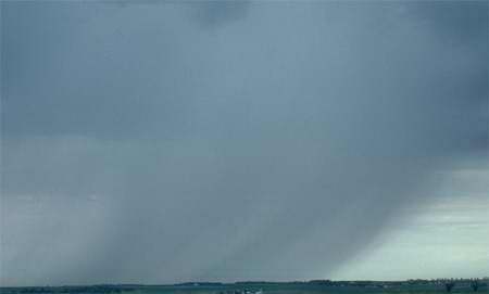 foggy-like withoutanydistinct shape or form. They also
can be seen hanging very low to the ground and covering most of the
sky. If you catch yourself under a blanket of this type of cloud, be
sure to have an umbrella athand. foggy-like withoutanydistinct shape or form. They also
can be seen hanging very low to the ground and covering most of the
sky. If you catch yourself under a blanket of this type of cloud, be
sure to have an umbrella athand.
- Cumulus Cloud (heap/pile):
These are the most familiar of all the cloud forms. Meaning heap orpile
in Latin,they are
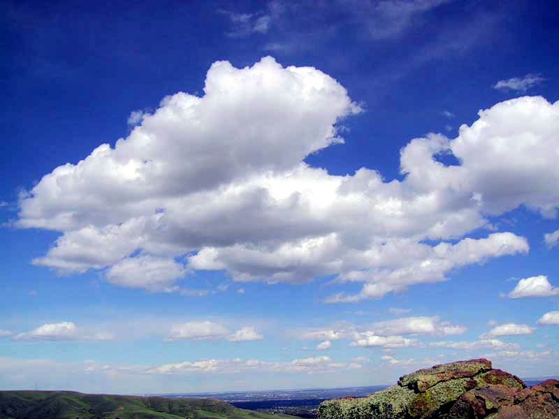 usually identified by their vertical development and clearly defined
edges.They are often puffy with a cotton-like appearance. When small
or medium sized, these clouds can often occur during fair weather. However
they can continue to grow into Cumulus-Congestus clouds which may produce
heavy rain, lightning, strong winds, hail, and even tornados. usually identified by their vertical development and clearly defined
edges.They are often puffy with a cotton-like appearance. When small
or medium sized, these clouds can often occur during fair weather. However
they can continue to grow into Cumulus-Congestus clouds which may produce
heavy rain, lightning, strong winds, hail, and even tornados.
- Stratus Cloud (layered):
Meaning blanket or layered, may be used to explain a "cloudyday" and
might
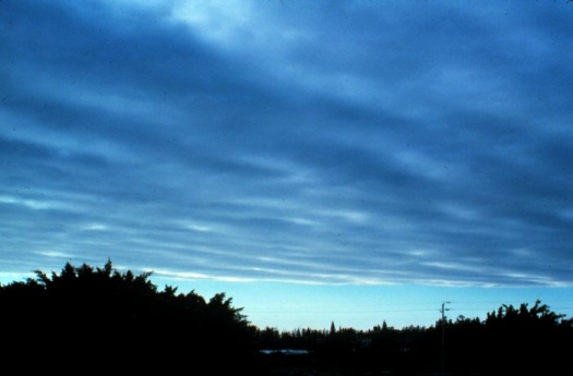 beotherwiseknown as "above-ground fog". They are low
to the ground and can vary in color from dark grey to almost white.
Also, these clouds are usually transparent and can bring a light drizzle
at most. beotherwiseknown as "above-ground fog". They are low
to the ground and can vary in color from dark grey to almost white.
Also, these clouds are usually transparent and can bring a light drizzle
at most.
- Stratocumulus Cloud (covering-mass):
These clouds are characterized by their large dark,
 rounded masses, usually in groups, lines and/or waves.
As for climate, these clouds can bring light rain or even snow. However,
they're often seen either before or after worse weather, so they may
indicate storms to come. rounded masses, usually in groups, lines and/or waves.
As for climate, these clouds can bring light rain or even snow. However,
they're often seen either before or after worse weather, so they may
indicate storms to come.
- Cumulonimbus Cloud (heap,
cloud/severe rain): When it comes to predicting any severe and
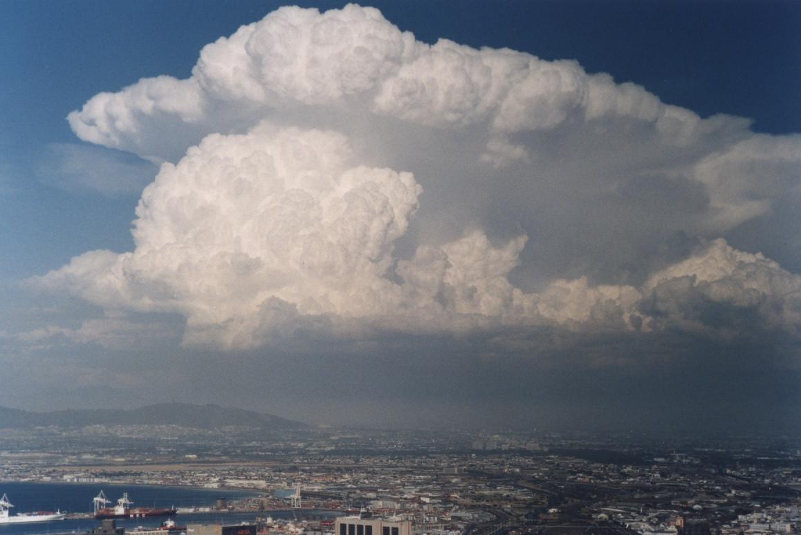 extreme weathersuch as super-cell thunderstorms, these clouds are
the most obvious. They are known for their mushroom-cloud resemblance
and are easily visible from a long distance away. If you see any of
these on the horizon, you can be sure trouble is on its way. extreme weathersuch as super-cell thunderstorms, these clouds are
the most obvious. They are known for their mushroom-cloud resemblance
and are easily visible from a long distance away. If you see any of
these on the horizon, you can be sure trouble is on its way.
2) Middle Clouds (6,500
ft. - 20,000 ft.) and Local Weather Forecast
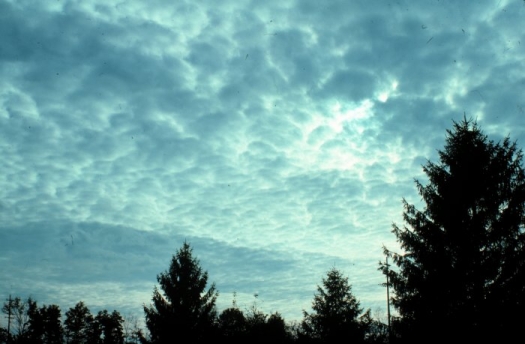
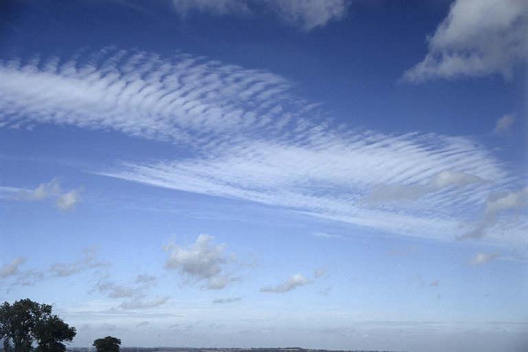
- Altocumulus Cloud (high-heaped):
Otherwise known as "Mackerel sky", these clouds have a similar appearance
to
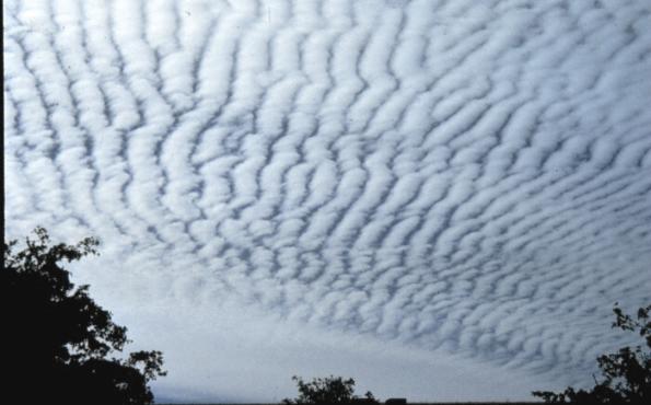 the markings on an adultKing Mackerel fish. They are
usually white or light gray and occur in sheets or patches with wavy,
rounded masses or rolls. Altocumulus clouds often develop preceding
a cold front. Likewise, their presence on a humid, summer morning frequently
signals the possibility of thundershowers later in the day. the markings on an adultKing Mackerel fish. They are
usually white or light gray and occur in sheets or patches with wavy,
rounded masses or rolls. Altocumulus clouds often develop preceding
a cold front. Likewise, their presence on a humid, summer morning frequently
signals the possibility of thundershowers later in the day.
- Altostratus Cloud (high-layered):
Similar to the low Stratus clouds, these condensed
 vapors are made of icecrystals in the atmosphere.Theyare
a result of lifted air masses that become compressed by incoming frontal
systems. They are also dangerous to aircrafts because they can cause
atmospheric icing or ice accretion. vapors are made of icecrystals in the atmosphere.Theyare
a result of lifted air masses that become compressed by incoming frontal
systems. They are also dangerous to aircrafts because they can cause
atmospheric icing or ice accretion.
3) High Clouds (above
20,000 ft.) and Local Weather Forecast
- Cirrocumulus Cloud (curl
of hair-heaped): The Cirrocumulus cloud is a high altitudecloud that
resembles
 theAltocumulus with a distinctive veil-like or fibrous
look. Like other Cumulus clouds, cirrocumulus clouds signify convection
which is movement of fluids and/or gasses and vapors in the air. Occasional
Virga or atmospheric precipitation, which evaporates before ever touching
the lower levels of the troposphere, is the most of what a person on
the ground might notice from these clouds. They are simply too high
above the earth to have any direct impact on the weather we experience. theAltocumulus with a distinctive veil-like or fibrous
look. Like other Cumulus clouds, cirrocumulus clouds signify convection
which is movement of fluids and/or gasses and vapors in the air. Occasional
Virga or atmospheric precipitation, which evaporates before ever touching
the lower levels of the troposphere, is the most of what a person on
the ground might notice from these clouds. They are simply too high
above the earth to have any direct impact on the weather we experience.
- Cirrus Cloud (curl of hair):
If you ever notice a large amount of Cirrus clouds, it may be a
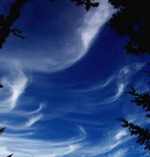 sign of an approaching frontal
system or upper airdisturbance which can imply climate changes in the
near future. Cirrus clouds can also be the remnants of a thunderstorm.
Also, a large shield of Cirrus and Cirrostratus typically accompany
the high altitude outflow of hurricanes, typhoons and/or increasingly
stormy weather. sign of an approaching frontal
system or upper airdisturbance which can imply climate changes in the
near future. Cirrus clouds can also be the remnants of a thunderstorm.
Also, a large shield of Cirrus and Cirrostratus typically accompany
the high altitude outflow of hurricanes, typhoons and/or increasingly
stormy weather.
-
Cirrostratus Cloud (curl
of hair-layered): These clouds are mostly composed of ice-crystals,
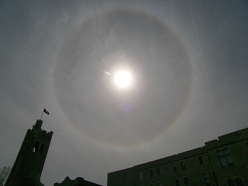 thus indicating a large amount of moisture in the upper atmosphere.
Like most other high altitude clouds, they don't generate any precipitation
on ground levels but can sometimes be a warning of a soon approaching
warm front which may lead to precipitation within the next 12 to 24
hours. thus indicating a large amount of moisture in the upper atmosphere.
Like most other high altitude clouds, they don't generate any precipitation
on ground levels but can sometimes be a warning of a soon approaching
warm front which may lead to precipitation within the next 12 to 24
hours.
How the Weather Center Works
A Modern Look at the Weather
Almanac
.
|